The Original Great Southern Brevet

Sunday, 22 January 2017

And the weather wins :-(

With the front rider in Wanaka a call had to be made on the risk and the route. With 20cm of fresh snow on Cardrona Skifield (which is below the summit of the Pisa Range) and forecast 90kph wind, it would be heavy and serious going.

So the call has been made to switch to the Alternate Leg 4 Wanaka to Cromwell:

From:
Date: 22 January 2017 at 11:18
Subject: SMS
To: GSB2017
Hello All, weather still severe and with 20cm snow at Cardrona Skifield, the Pisa Tops will be heavy going. Wind also 70-90kph on tops. Please use the alternate leg 4 Wanaka to Cromwell over Crown Range to Robins Track to Arrowtown and then track to Gibbston Valley and Cromwell. GSB2017.


The alternate Leg 4 Wanaka to Cromwell via the Crown Range to Arrowtown and then the Gibbston Valley Cycle Trail and State Highway 6 to Cromwell.

Midday Txt - still very wet!


A few very late, or very early, txts depending on when you went to bed and got up ;-)
 
Date: 21 January 2017 at 23:57
Subject: SMS with Matty Graham
In oh my cow checking out the night life.
More than a bit wet!

Date: 22 January 2017 at 04:54
Subject: SMS with +64210478197
CliffCliff checking @ #two

Date: 22 January 2017 at 04:57
Subject: SMS with Brian Alder
Oturehua. a week bit damp last night.

Date: 22 January 2017 at 05:13
Subject: SMS with Craig Phillips
Spent night under shelter in Otarahua... bonus!

Date: 22 January 2017 at 10:29
Subject: SMS with Fleur Pawsey
Fleur and Dean in Omakau getting hot coffee. Challenging night last night. The mud. The mud of nightmares and doom! Pleased our bikes survived to ride another day...

Date: 22 January 2017 at 10:37
Subject: SMS with Matty Graham
Wanaka. Matty

Weather dominates Day 2

Day 2 on the Great Southern Brevet and the weather is definitely not cooperating. Persistent rain overnight hasn't eased and the wind has picked up. What little view there is doesn't bode well :-(
 

Yes that is white stuff on the tops, and only around 1000 metres. Looking down Broken Hut Road to the St. Bathans Range.


Matt Hughes and Michael Hoogeveen start the climb to Little Omarama Saddle. It doesn't look so bad? 
It gets worse very fast!

The view back down to Broken Hut Road, before it disappeared.


And the view on the top.....


Down in the Manuherikia. Think Ian Huntsman and Wendy Riach are less than impressed with the weather even with every bit of clothing they have on!


Nathan Mawkes drowned but smiling at Falls Dam. — with Andrew Scott.


Late Day 1 Txt Messages from the field

Late txt from end of Day 1 on the Great Southern Brevet. Riders more than happy to be stopping for the night!

Date: 21 January 2017 at 19:13
Subject: SMS with Peter Maindonald
Omarama for diner, a bit beaten but otherwise fine...

Date: 21 January 2017 at 19:37
Subject: SMS with Dean Marshall
Dean in Omarama

Date: 21 January 2017 at 19:42
Subject: SMS with Richard Harding
Richard harding Haha made it stopping here and pushing on in the morning leg one complete an awesome day

Date: 21 January 2017 at 20:48
Subject: SMS with Bryan Prestidge
Bryan in otematata for the night. Finishing route and heading back to Timaru tomorrow. Thanks and have fun everyone

Date: 21 January 2017 at 21:15
Subject: SMS with Jane Liddle
Hot fire and hot shower at Otematata. All good.

Saturday, 21 January 2017

Omarama it is!

With the less than inviting forecast for heavy rain all night a large contingent have settled in Omarama for the evening.

From cold and wet to well fed and dry!

First day txt from the riders

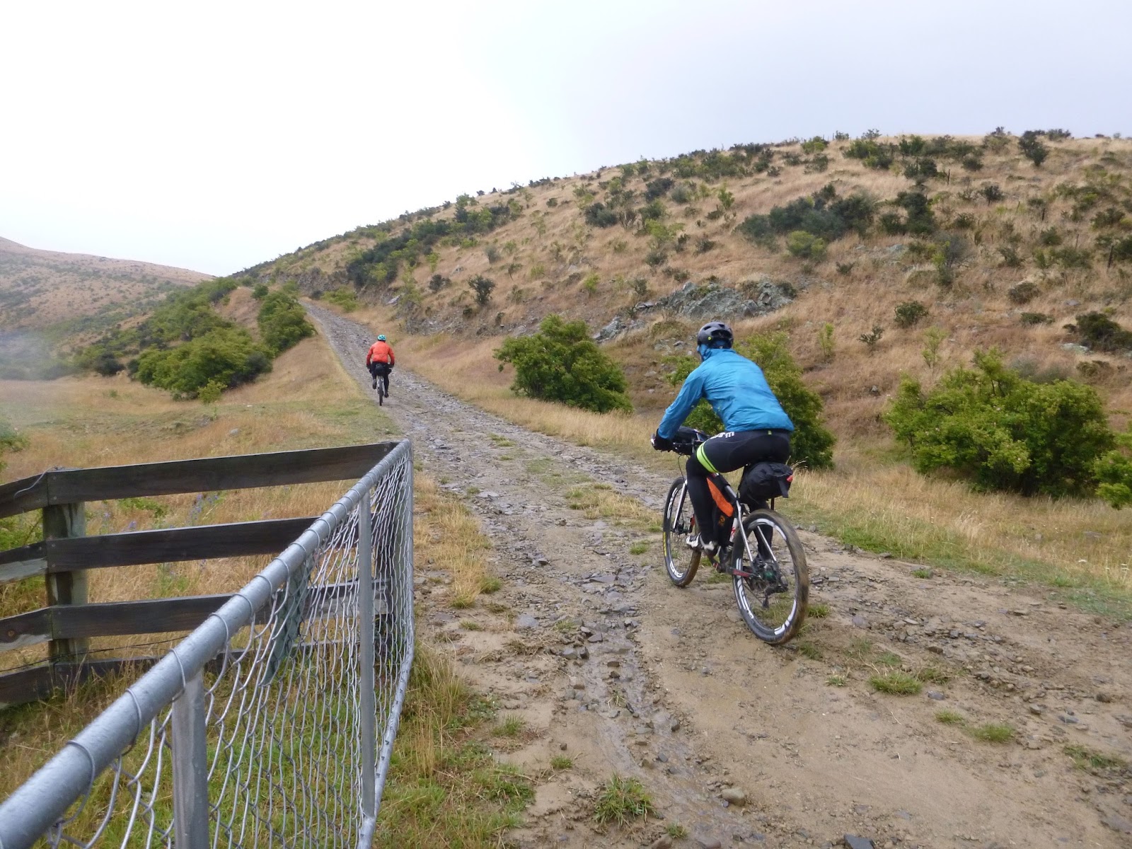
Riders have to send a txt once they arrive at checkpoints along the ride. These usually start out very dry but as the day drags on and they get tired (and wet) the txts became a little more animated. Today's txts:

Date: 21 January 2017 at 15:43
Subject: SMS with +64210478197
Cliff checking @ #1

Date: 21 January 2017 at 15:44
Subject: SMS with Dave Sharpe
Cookin MCs like a pound of bacon @Otematata

Date: 2017-01-21 15:48 GMT+13:00
Subject: SMS with Matty Graham
Otematata. Matty

Date: 21 January 2017 at 16:23
Subject: SMS with Dean Ford
Fleur and Dean checking in at otematata. Starting to rain...

Date: 21 January 2017 at 16:34
Subject: SMS with Linda Wensley
Linda wensley in otamatata

Date: 21 January 2017 at 16:38
Subject: SMS with Andrew Scott
At Omarama

Date: 21 January 2017 at 16:39
Subject: SMS with Andrew Scott
Correction at Otematata. Brain mushy, legs quivering, looking for a roof.

Date: 21 January 2017 at 16:49
Subject: SMS with Rob Davidson
Rob Davidson texting in from Sailors Cutting. A little tailwind push after Otematata😀

Date: 21 January 2017 at 17:04
Subject: SMS with Craig Phillips
Late text in from Omarama. Got overwhelmed by technology in Otematata! All good...

Date: 21 January 2017 at 17:09
Subject: SMS with Michael Hoogeveen
It's been a long ride to the first beer 🍻

Date: 21 January 2017 at 17:10
Subject: SMS with Dave Sharpe
Moist in Omarama

Date: 21 January 2017 at 17:20
Subject: SMS with Wendy Raich
Ian and Wendy are in a wet and cold otematata. A bit lumpy after Dave left us

Date: 21 January 2017 at 17:58
Subject: SMS with Rob Halliday
Isn't tekapo river road smooth!!!!!

Date: 21 January 2017 at 17:58
Subject: SMS with Pete Barnes
Hi Dave. At otematata. Refueling! From Pete Barnes and pascal.

Date: 21 January 2017 at 18:00
Subject: SMS with Matthew Hughes
Know if any shelter in omarama?

Date: 21 January 2017 at 18:00
Subject: SMS with Matthew Hughes
Leg 1 completed with Mike. Very wet at the pub drinking beer ;)

Date: 21 January 2017 at 18:09
Subject: SMS with Russell Lory
Arrived in otematata ... Russ

Date: 21 January 2017 at 18:40
Subject: SMS with Andrew Scott
Sorry Dave left my name off txt in. Andrew Scott is now in the Omarama Hotel for the night.


A quiet afternoon out on the course

As the riders got down to the business of clocking up the first few kms things quieten down. Still a few smiles but mostly all business.

Matt doesn't miss a stride as he tosses his bike over the gate at Black Forest Station

Ian and Wendy started up the hill proper
Pascal epitomizing the laid back approach

Bryan still smiling while Jane is all focus


Cool temperatures for the start of GSB2017

A cool, overcast morning for the start of the Great Southern Brevet 2017.

Last minute preparations

A few words of warning about the weather

And they're off!


And the pace picks up as the head out onto the leg proper along the Tekapo canal. Next stop Otematata just a short 101 kms away.


Alternate Leg 4 Details

With the forecast for heavy rain and high winds still in effect for Central Otago it is prudent to have a Plan B.
 
The alternate Leg 4 from Wanaka to Cromwell will be via the Crown Range and Gibbston Valley should the weather not improve.
 
A large number of riders expressed their preference to remain on the original course (over the Pisa Range). We can make a call on this on Saturday. For now it is prudent to have an alternate plan available and communicated.

This route was marginally favoured over the Queenstown option as it avoided waiting for a boat, and returned to the original course quicker. It also maintains options for those who wish/need to shortcut sections.

The only drawback of the route is a 300 metre section at Gentle Annie Bluff. NZTA have chosen to erect centreline road barriers after several incidents with drivers crossing the road centreline. Great option to protect drivers from themselves but profoundly stupid on the part of NZTA as they provided no options for cyclists to safely use the route. Please be extra careful on this section. There is little room to maneuver on an already narrow road.

The route is:

Follow the Crown Range Road out of Wanaka to the Cardrona Valley and up over Crown Saddle
Drop down to Crown Flats and hang a right into Glencoe Road and then left onto Tobins Track to Arrowtown
Leaving Arrowtown, follow the Arrow River Bridges Trail (back down the Arrow River) out towards the Kawerau River
After crossing State Highway 6 keep an eye out for the left turn to Gibbston River Cycle Trail
Stay on the Cycle Trail till it runs out before Nevis Bluff and then join State Highway 6 to Cromwell
The GPX and Cue Sheet for the Alternate Leg 4 Wanaka to Cromwell can be found at the following links.

Alternate Leg 4 Wanaka to Cromwell GPX File

Cue Sheet for Alternate Leg 4 Wanaka to Cromwell

Fingers crossed we won't need it and the weather improves!

Thursday, 19 January 2017

Weather Bomb!

Never a dull moment with the Great Southern Brevet. The forecast weather bomb is currently blasting Wellington with 150 kph winds. There is a severe weather warning for the Central Otago region with gale force winds on the tops and a freezing level down to 1400 metres.

The crossing of the Pisa Range via the high route was due to the Roaring Meg Track closure. This route rises to just shy of 2000 metres and has a short but very exposed section at Sallys Pinch. There would be significant risk riding in those conditions. Common sense would dictate that riders wait out for the weather to improve (forecast for later Sunday/Monday improving). However it is understandable many riders would like to progress.

Metservice Severe Weather Forecast January 2017

Two options have been developed which will keep riders largely below the worst of the weather (there is no guarantee you won't get wet though!).

Option 1 and 2 share the same first section and that is Wanaka to Arrowtown. From there they split with:

Option 1 heading east to Cromwell via the Gibbston Valley Cycle Travel and the Kawerau Gorge. From there it rejoins the current route and proceeds over the Nevis and down the Round the Mountain Trail to Lumsden and onto Waikaia.

Option 2 leaves Arrowtown on the Queenstown Cycle Trail for Queenstown. From there it is a ride on the Earnslaw to Walter Peak and the Round the Mountain Cycle Trail to Lumsden and onto Waikaia.

Option 3 Of course we could just wait and see what the weather is like and carry on over the original course. For the front runners there is a risk but for those arriving in Wanaka and heading for the Pisa Range Sunday/Monday things should be improved.

Both alternate routes (Option 1 and 2) are within 10kms distance of the original route. The Queenstown option being less riding as you use the Earnslaw for some of your trip ;-)

Please check out the Google Map of the options below (click on the map icon below and it will open Google Maps):


Please Vote for an option below:

GSB2017 Weather Bomb Route Options Voting Form

Tuesday, 10 January 2017

Time to get your SPOT on!

If you have your own SPOT Tracker or you need to hire one, it's time to register. Tracking will again be available this year so be sure to share the tracking link with friends and family so they can enjoy watching you suffer, oops, bath in the sunlight!

You will have to enter some of the details again as the service provider has a separate registration system but hopefully it is only a cut and paste. Check out the Live Tracking tab above or the links below to register.

Benmore Dam...  your target for the first day of riding

If you are a rider and have a SPOT Tracker yourself, or need to hire a SPOT Tracker, please use the links below.

The first link is to register your details with the service provider and the second is to register you against the Great Southern Brevet 2017 ride. Both are needed to complete the process.

Register my SPOT or let me hire a SPOT device

Once you have registered for an account at MAProgress then join the event using the link below:

I want to join the GSB 2017 Tracking

We have some good news, and some less good news!

And no bad news, just more opportunities to ride your bike!

The good news is the course is done and the GPX is available (see link below).

As much as the Great Southern Brevet is a challenge to ride, it also has it's challenges to organise. Ignoring busy life for a moment, the every changing landscape of access creates the need to check and gain permissions along the route.

The Great Southern Brevet is an off-road bike-packing event. By definition it travels lesser used paths which are often on public land (conservation areas, reserves, parks, etc.) and occasionally on private land. Access to this land, both public and private, changes over time.

Central Otago has developed into a dichotomy of land access. More and more cycle trails are being developed for use by everyone, while at the same time more and more landowners are restricting access to a few (and sometimes none).

Cycle trails are a good thing, besides the economic and health benefits it is just plain more fun to ride without looking over your shoulder for vehicles (and hence the Great Southern Brevet). But the push for these new cycle trails has heightened resentment, sometimes deep, from land owners and land custodians.

This years GSB has changes as land issues boil over and unfortunately fall short of getting resolved. You will see some quirks of the land access issue as you travel (more about those at the briefing).
However you will also get to ride your bike through some spectacular countryside thanks to the generosity of landowners.

So as you curse having to throw your bike over a locked gate you can also celebrate you get to ride in such a diverse and challenging landscape.

The road less travelled... The Nevis

GSB 2017 Route GPX

The Cue Sheet for the GSB 2017 will be posted soon. The updates will hopefully be complete tonight. Check back if you plan on carrying it for back up or as your primary navigation aid.